Assiniboine Lodge Via Bryant Creek And Assiniboine Pass
Distance: 27.5 km (17.1 miles)
Elevation gain: 460 meter gain (1,509 feet) after an initial loss of 65 m (213 feet)
Allow: 8 hours
Gem Trek hiking map: Banff and Mount Assiniboine
Topographical maps: Mount Assiniboine 82 J/13 and Banff 82 O/4.
Trailhead: The Mount Shark Trail Head.
Trail closures: The hikers high trail over Assiniboine Pass is closed between August 1st-September 30th to reduce human-grizzly bear conflicts. Assiniboine Pass can be reached via the lower horse trail. There are no bikes allowed west of Trail Center.
Banff National Park information: permits are required for overnights on the Bryant Creek access route.
Trail description
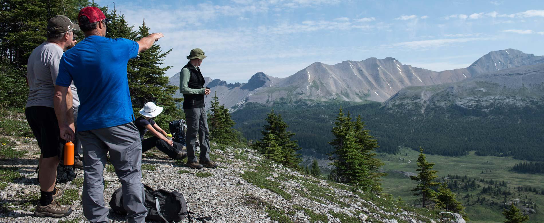
The most popular route to Assiniboine is through Bryant Creek and over Assiniboine Pass. It is a well-marked trail. The helicopter flight path to Assiniboine follows this hiking route and expect to hear helicopter noise on flight days. Most of the hike follows a creek bottom, so the scenery doesn’t start opening up until the Bryant Creek Warden's Cabin.
The trailhead is the stadium for the Mount Shark cross-country ski trail system. Travel along an old logging road and through the maze of ski trails. The trail passes the Watridge Lake/Karst Trail turnoff (3.7 km), descends a steep hill and crosses a bridge over the Upper Spray River (5.9 km). Continue right (west) at the Palliser Pass Junction (6 km). Cross the Bryant Creek Bridge (6.6 km). Climb a small hill and at the crest turn left following the trail to Trail Center (6.7 km). At Trail Center, the trail forks to the left to a Banff National Park Warden's Cabin. Take the right fork following signs for Assiniboine. Bikes are not permitted west of Trail Center.
The trail climbs gently past the first of the Banff National Park campground at Big Springs BR9 Campground (9.6 km). Continue past the Owl Lake Junction (12 km), the junction for the Marvel Lake BR13 Campground (13 km) and the primitive Bryant Creek Shelter (13.6 km) and McBride’s Camp BR14 (14km). The trail to Wonder Pass branches off to the left at the Bryant Creek Warden’s cabin (14.3 km). Keep following the Bryant Creek Trail past the Bryant Creek Warden's Cabin. At the end of the meadow, cross a stream and enter the woods. Continue past the Allenby Junction BR 17 campground (17.5 km).
Reach the hikers high trail and the horse trail junction (17.8 km). The trail splits into a hiker's high trail (to the right) and a lower horse trail (to the left). It is recommended to turn right and take the hiker's high trail. The hikers high trail turns left at the Brewster Creek/Og Pass/Allenby Pass Junction (18 km) and starts it’s stiff climb up Assiniboine Pass. The high hiking trail and the lower horse trail join below the summit of Assiniboine Pass (22.4 km).
The hikers high trail is closed between August 1st- September 30 to reduce human-grizzly bear conflicts. At this time, Assiniboine Pass can be reached via the lower horse trail. At the junction between the hikers high trail and the horse trail junction (17.8 km), turn right over a bridge and continue up the steep switch backs until you rejoin the high hiking trail (22.4 km) below the summit of Assiniboine Pass.
Before the summit of Assiniboine Pass be attentive and follow the hiking trail, as it turns left, up the final hill to Assiniboine Pass (23 km). Do not follow the old horse trail as it has led some people to Og Meadows. At Assiniboine Pass there is a B.C. Parks information booth marking your entrance into Mount Assiniboine Provincial Park, the Great Divide and the Alberta/British Columbia border.
From Assiniboine Pass it is approximately a 2.1 km hike to Assiniboine Lodge. Continue down Assiniboine Pass and past the O’Brien Meadow Group Campground. Continue past the Og Lake junction. At the next Y junction, follow the signage and the trail branching to the right for the Magog Campground. The Magog Campground is 1.3 km from this junction. Follow the signage and take the trail branching to the left for Assiniboine Lodge and the Naiset Huts. Assiniboine Lodge is 100 meters from the junction. For the Naiset Huts continue past Assiniboine Lodge and turn left after the second lodge cabin. The Naiset Huts are 500 meters past the Assiniboine Lodge toward Wonder Pass.
Assiniboine Lodge To The Mount Shark Trialhead Via Wonder Pass And Bryant Creek
Distance: 26.1 km (17 miles)
Elevation gain: 205 meters (670 feet)
Elevation loss: 580 meters (1,900 feet)
Maximum elevation: 2395 meters (7,850 feet)
Allow: 9 hours
Gem Trek hiking map: Banff and Mount Assiniboine
Topographical maps: Spray Lakes Reservoir 82N/14 and Mount Assiniboine 82J/13
Trail closures: There are no bikes allowed west of Trail Center.
Banff National Park information: permits are required for overnights on Bryant Creek access route
Trail Description
The scenery on this route is spectacular. From Assiniboine Lodge, hike past the Naiset Huts (0.5 km) and along Gog Creek. Shortly after crossing the creek (1.1 km) you will reach Gog Lake. In 1983, great blue herons nested Gog Lake- the highest nesting elevation recorded for this species. From here the trail climbs through larch forests and open meadows filled with wildflowers to Wonder Pass (3.1 km). At Wonder Pass, the trail continues into Banff National Park in subalpine terrain. After the first view of Marvel Lake the trail steadily descends in a series of switchbacks. Keep left (southeast) at the Marvel Pass junction (6 km). The Wonder Pass Trail traverses across a number of large avalanche slopes on the southern flanks of Wonder Peak.
The trail re-enters the forest at the east end of Marvel Lake. Continue straight on the main trail at Marvel Lake Campground junction (10.6 km). Cross Bryant Creek bridge (11.6 km). Connect and turn right at the Bryant Creek/Assiniboine Pass Trail (11.9 km). Continue past the Bryant Creek Warden's Cabin (14.3 km). Pass the first of the overnight options located in Banff National Park- McBride’s Campground BR14 (14km). Next you will pass the primitive Bryant Creek Shelter (13.6 km) located in the clearing. The next junction is for the Marvel Lake BR13 Campground (13 km), which is followed by the Owl Lake Junction (12 km). The last campground is Big Springs Campground BR 9 (9.6 km). At Trail Centre (6.7 km) and a junction for a Banff National Park Warden's Cabin, continue straight. The trail forks with the left fork leading to Spray Lake northwest shore. Take the right fork (south) following signs for Mount Shark Trailhead. Cross the Bryant Creek Bridge (6.6 km) and turn left (east) at the Palliser Junction (6 km). Cross the Upper Spray River Bridge (5.9 km). The trail goes up a steep hill and becomes a road as you approach Watridge Lake/Karst turnoff (3.7 km). Travel along an old logging road and notice the maze of ski trails intersecting the Assiniboine trail. Follow the road to the Mount Shark Trailhead.
Assiniboine Lodge Via Sunshine
Distance: 30 km (18.7 miles)
Elevation gain: 400 meter gain (1,312 feet)
Maximum elevation: 2,360 meters (7,750 feet)
Allow: 1-2 days. If you choose to hike up the gravel road instead of taking the gondola from the Sunshine Ski Area parking lot to Sunshine Village, add 6.5 km (4.0 miles), 525 meters (1, 722 feet) of elevation gain and up to 2 to 3 hours.
Gem Trek hiking map: Banff and Mount Assiniboine
Topographical maps: Mount Assiniboine 82 J/13 and Banff 82 O/4).
Trailhead: Sunshine Village Ski and Snowboard Resort
Parking lot: Sunshine Village Ski and Snowboard Resort parking lot.
Sunshine Village Shuttle bus rates and times: Sunshine Village Resort
Banff National Park information: Permits are required for overnights on the Sunshine access route
Assiniboine Provincial Park information:Porcupine Campground is approximately 13 km from Sunshine Village, Permits are required for Porcupine Campground.
Trail description
From the Sunshine Interpretive Center follow the Citadel Pass trail uphill to the southeast. After a brief climb, reach the alpine meadows of the Great Divide (1.2 km). At the Rock Isle lake Junction (1.3 km) turn left to Citadel Pass. After crossing a ridge underneath Quartz Hill the trail drops down to a Banff National Park campground on the shores of Howard Douglas Lake (5.8 km). Fill your bottles at Howard Douglas Lake as it might be the last water before Og Lake.
On the summit of Citadel Pass (9.3 km-2,360 meters) continue straight ahead on the Og Lake/Assiniboine Trail. There is a steep descent down Citadel Pass and a junction to the first Assiniboine Provincial Park campground on the Sunshine access route at Porcupine (12.5 km). If you are a though hiker and not camping at Porcupine, do not dip down into the Golden Valley. Follow the traverse on the steep open side hill. Enter Valley of the Rocks, a bizarre jumble of rocks from an ancient landslide. There is no water in this 6 km section. Travel past the Og Lake Campground (22.2 km), with the spectacular view of Mount Assiniboine.
Cross the expansive Og Meadows. Continue straight ahead at the Og Pass junction (26.3 km) and up a gully. Continue in the direction of travel at the trail junction for Assiniboine Pass (27.0 km). At the next Y junction (27.3), follow the trail branching to the right for the Magog Campground. The Magog Campground is 1.4 km km from this junction. Take the trail branching to the left for Assiniboine Lodge and the Naiset Huts. Assiniboine Lodge is 200 meters from the junction. For the Naiset Huts continue past Assiniboine Lodge and turn left after the second lodge cabin. The Naiset Huts are 500 meters past Assiniboine Lodge towards Wonder Pass.
Trip Planning Suggestions For Accessing The Park By Hiking
-
Persons visiting Mount Assiniboine Provincial Park are reminded that the park is a wilderness area, without supplies or equipment of any kind. All arrangements for supplies and transportation must be made beforehand.
-
Hiking to and from Assiniboine requires good fitness and a positive attitude. The time it takes will be dependent on the route, fitness of the weakest member of your hiking group, trail conditions and the weight of your backpack. It typically takes experienced hikers, with a light daypack, between 7-10 hours.
- The best hiking is at Assiniboine. If you want to hike one way, consider flying in and hiking out. You have more energy to enjoy Assiniboine.
- Consider flying your non-essential gear on the helicopter and hike with a daypack.
- Plan an early departure.
- Be prepared. Mountain weather can change dramatically over short periods of time. Bring adequate clothing, food, water, a map and a first-aid kit.
- Hike with a partner.
- Bring bear spray.
- Do not leave anything valuable inside your car at the trailhead.
Hiking via Bryant Creek
- If you are planning to hike both ways through Bryant Creek, hike in over Assiniboine Pass and hike out over Wonder Pass. It is the same Trailhead- the Mount Shark Trailhead. There is less elevation gain on the way in through Assiniboine Pass and you can appreciate the view as you hike out over Wonder Pass.
- If you are hiking out through Bryant Creek, consider hiking out over Wonder Pass. It has more elevation gain than the Assiniboine Pass route but the pay off in views makes it worthwhile.
- Be prepared for helicopter noise through Bryant Creek as the Assiniboine flight path follows the hiking route.
Hiking via Sunshine
- An alternative route, for experienced day hikers or overnight backpackers is via Sunshine. This route is undoubtedly the most beautiful and varied approach into Assiniboine.
- Be wary of substantial elevation changes and limited water through Valley of the Rocks.This route can challenge even experienced day hikers.
- The Sunshine route involves access via hiking up the ski out 6.5km or taking the gondola. The access point is the parking lot for the Sunshine Village Ski and Snowboard Resort, located 18 km west of Banff. The trailhead is 6.5 km via shuttle bus, gondola or hike from the parking lot. For more information on access, visit Sunshine Village online.
- The Sunshine access point is a different from the Mount Shark Trailhead and the Mount Shark Helipad. If you are not hiking both ways to Sunshine or plan to fly one way, the Sunshine route will require a car shuttle from Mt Shark or Canmore heliports that you'll need to arrange on your own.